
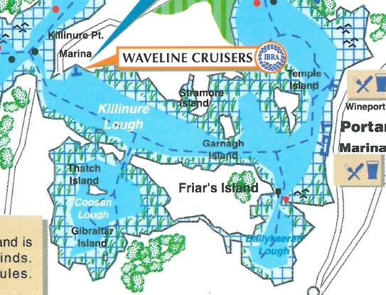
Killinure Lough
| Killinure Lough | |
|---|---|
| Loch Choill an Iúir Error {{native name checker}}: parameter value is malformed (help) | |
 | |
 Killinure Lough | |
| Location | County Westmeath, Ireland |
| Coordinates | 53°27′34″N 7°53′50″W / 53.459369°N 7.897106°W |
| Primary inflows | Breensford River, Coosan Lough, Glassan River |
| Primary outflows | Lough Ree |
| Basin countries | Ireland |
| Surface area | 2.6 km2 (1.0 sq mi) |
| Surface elevation | 36 m (118 ft) |
| Islands | Temple's Island, Thatch Islands East, Cookanamuck, Garnagh Island, Sramore Islands, |
| Settlements | Glassan, Ballykeevan |
Killinure Lough is a lake in County Westmeath, Ireland, which feeds into Lough Ree on the Shannon.[1][2]
Wildlife
The lough is a brown trout and eel fishery.[3][4]
See also
References
This article related to the geography of County Westmeath, Ireland is a stub. You can help Wikipedia by expanding it. |