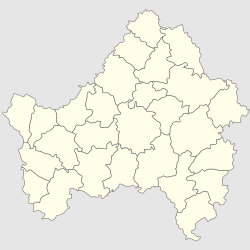
Kletnya
Appearance
Kletnya
Клетня | |
|---|---|
| Coordinates: 53°23′23″N 33°13′2″E / 53.38972°N 33.21722°E | |
| Country | Russia |
| Federal subject | Bryansk Oblast |
| 1880 | 1880 |
| Town status since | 1935 |
| Population | |
| • Total | 13,313 |
| • Municipal district | Kletnyansky Municipal District |
| • Urban settlement | Kletnyansky Urban Settlement |
| • Capital of | Kletnyansky Municipal District, Kletnyansky Urban Settlement |
| Time zone | UTC+3 (MSK |
| Postal code(s)[3] | 242820 |
| Dialing code(s) | +7 48338 |
| OKTMO ID | 15626151051 |
Kletnya (Russian: Клетня) is a town in Bryansk Oblast, Russia. It is located on the Nadva River (Dnieper basin), 99 km west of the city of Bryansk. It's the final railway station (43 km) from the Zhukovka (on the line Bryansk - Smolensk).
History
The town was founded in 1880 in connection with the start of logging areas. originally was called Lyudinka. Since 1918 it was a rural center of Bryansk District, since 1929 the administrative center of the district bearing the same name. In 1935 it was granted an Urban-type settlement status.
During the Great Patriotic War Kletnyanskoy forests were one of the centers of the partisan movement.
On June 28, 2012 the town awarded the honorary title "Settlement of Partisan Glory" by the regional government.
References
- ^ Russian Federal State Statistics Service (2011). Всероссийская перепись населения 2010 года. Том 1 [2010 All-Russian Population Census, vol. 1]. Всероссийская перепись населения 2010 года [2010 All-Russia Population Census] (in Russian). Federal State Statistics Service.
- ^ "Об исчислении времени". Официальный интернет-портал правовой информации (in Russian). 3 June 2011. Retrieved 19 January 2019.
- ^ Почта России. Информационно-вычислительный центр ОАСУ РПО. (Russian Post). Поиск объектов почтовой связи (Postal Objects Search) (in Russian)


