
Koliganek, Alaska
Koliganek
Qalirneq | |
|---|---|
 Location of Koliganek, Alaska | |
| Country | United States |
| State | Alaska |
| Census Area | Dillingham |
| Area | |
| • Total | 12.5 sq mi (32.4 km2) |
| • Land | 12.5 sq mi (32.3 km2) |
| • Water | 0.1 sq mi (0.1 km2) |
| Population (2000) | |
| • Total | 182 |
| • Density | 14.6/sq mi (5.6/km2) |
| Time zone | UTC-9 (Alaska (AKST)) |
| • Summer (DST) | UTC-8 (AKDT) |
| Area code | 907 |
| FIPS code | 02-41500 |
Koliganek (Qalirneq in Central Alaskan Yup'ik) is a census-designated place (CDP) in Dillingham Census Area, Alaska, United States. At the 2000 census the population was 182.
Geography
Koliganek is located at 59°43′44″N 157°16′38″W / 59.72889°N 157.27722°WInvalid arguments have been passed to the {{#coordinates:}} function (59.728817, -157.277244)Template:GR.
According to the United States Census Bureau, the CDP has a total area of 12.5 square miles (32 km2), of which, 12.5 square miles (32 km2) of it is land and 0.1 square miles (0.26 km2) of it (0.40%) is water.
Demographics
As of the censusTemplate:GR of 2000, there were 182 people, 53 households, and 35 families residing in the CDP. The population density was 14.6 people per square mile (5.6/km²). There were 77 housing units at an average density of 6.2/sq mi (2.4/km²). The racial makeup of the CDP was 10.44% White, 87.36% Native American, 2.20% from other races. 2.20% of the population were Hispanic or Latino of any race.
There were 53 households out of which 43.4% had children under the age of 18 living with them, 52.8% were married couples living together, 9.4% had a female householder with no husband present, and 32.1% were non-families. 26.4% of all households were made up of individuals and 5.7% had someone living alone who was 65 years of age or older. The average household size was 3.43 and the average family size was 4.44.
In the CDP the population was spread out with 42.3% under the age of 18, 6.6% from 18 to 24, 31.3% from 25 to 44, 11.5% from 45 to 64, and 8.2% who were 65 years of age or older. The median age was 26 years. For every 100 females there were 122.0 males. For every 100 females age 18 and over, there were 133.3 males.
The median income for a household in the CDP was $44,583, and the median income for a family was $51,042. Males had a median income of $31,250 versus $30,417 for females. The per capita income for the CDP was $13,242. About 14.9% of families and 19.3% of the population were below the poverty line, including 20.0% of those under the age of eighteen and 53.3% of those sixty five or over.
References
59°43′44″N 157°16′38″W / 59.728817°N 157.277244°W
Municipalities and communities of Dillingham Census Area, Alaska, United States | ||
|---|---|---|
| Cities | 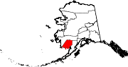 | |
| CDPs | ||
| Unincorporated communities | ||
| Ghost towns | ||