Kollmoor
Kollmoor | |
|---|---|
| Coordinates: 53°55′14″N 9°35′45″E / 53.92056°N 9.59583°E | |
| Country | Germany |
| State | Schleswig-Holstein |
| District | Steinburg |
| Municipal assoc. | Breitenburg |
| Government | |
| • Mayor | Wilfried Gatzke |
| Area | |
| • Total | 3.34 km2 (1.29 sq mi) |
| Elevation | 5 m (16 ft) |
| Population (2022-12-31)[1] | |
| • Total | 35 |
| • Density | 10/km2 (27/sq mi) |
| Time zone | UTC+01:00 (CET) |
| • Summer (DST) | UTC+02:00 (CEST) |
| Postal codes | 25524 |
| Dialling codes | 04821 |
| Vehicle registration | IZ |
| Website | www.amt-breitenburg.de |
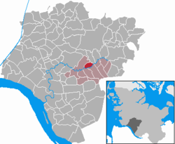
Kollmoor is a municipality in the district of Steinburg, in Schleswig-Holstein, Germany.
Geography and transport
[edit]Kollmoor is located approximately three kilometers east of Itzehoe along the Stör river. To the north of Kollmoor runs Bundesstraße 206 from Itzehoe to Bad Segeberg, while to the southwest lies Bundesautobahn 23 from Hamburg to Itzehoe. The southern boundary of the municipality is defined by the middle of the Stör river. The Stör river and a narrow strip of land along its banks within the municipal area are part of the European NATURA 2000 protected area FFH-Gebiet Schleswig-Holsteinisches Elbästuar and adjacent areas.[2] To the east, the boundary of the municipality alternates between the right and left banks or the middle of the Rantzau river.
Politics
[edit]As the municipality has fewer than 70 inhabitants, it has a community assembly instead of a municipal council; all citizens of the municipality belong to this assembly.
Economy
[edit]The municipal area is characterized by agriculture.
Notable people
[edit]- Julius Seeth (1863–1939) - A lion tamer, born in Kollmoor.
References
[edit]- ^ "Bevölkerung der Gemeinden in Schleswig-Holstein 4. Quartal 2022" (XLS) (in German). Statistisches Amt für Hamburg und Schleswig-Holstein.
- ^ "FFH-Gebiet Schleswig-Holsteinisches Elbästuar und angrenzende Flächen in der Gemeinde Kollmoor". DigitalerAtlasNord. Landesamt für Vermessung und Geoinformation Schleswig-Holstein. Retrieved 2022-10-26.


