Kongshamn
Appearance
You can help expand this article with text translated from the corresponding article in Norwegian. (June 2012) Click [show] for important translation instructions.
|
Kongshavn | |
|---|---|
Community | |
 | |
| Country | Norway |
| Region | Sørlandet |
| County | Aust-Agder |
| Time zone | UTC+01:00 (CET) |
| • Summer (DST) | UTC+02:00 (CEST) |

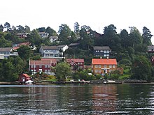
Kongshavn or Kongshamn is a community in the municipality of Arendal in Aust-Agder county, Norway. Its population (2009) is 862.[1] Kongshavn is located on the north side of Tromøy island, across the Tromøysundet from Eydehavn. It is about 11 kilometres (6.8 mi) east of the city of Arendal.[2] It is said that Kongshamn was a safe haven for king's ships during the Viking Age.
Kongshavn translates into "King's Landing" or "King's Port"
References
- ^ Statistisk sentralbyrå (1 January 2009). "Urban settlements. Population and area, by municipality".
- ^ Store norske leksikon. "Kongshamn" (in Norwegian). Retrieved 2010-04-16.
