Koritnik
Appearance

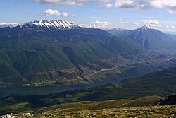
Koritnik or Koritniku (Template:Lang-sq, Serbian Cyrillic: Коритник) is a mountain located in north-eastern Albania and the south of Kosovo[a]. It is 2,393 m (7,851 ft) high. It is totally surrounded by branches of the White Drin. In Kosovo the towns of Šar and Zur are next to the mountain. The Koritnik mountain because of its high pastures contains a population of 60 chamois.
Notes
| a. | ^ Template:Kosovo-note |
42°05′00″N 20°34′00″E / 42.083333°N 20.566667°E [1]
References
- ^ "NGA GEOnet Names Server". National Geospatial-Intelligence Agency. 2009-09-09. Retrieved 2010-01-01].
{{cite web}}: Check date values in:|accessdate=and|date=(help)
