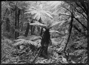
Korokoro, New Zealand

Korokoro, a suburb of Lower Hutt City, lies in the south of the North Island of New Zealand. The suburb occupies part of the western hills of the Hutt Valley; its eastern slopes overlook Petone and the Wellington harbour.
Korokoro was established in the 1900s by the Liberal government (in office 1891-1912), and remained a relatively small settlement until the Lower Hutt City Council developed the area for private housing in the 1960s.[2][failed verification]. Before 1989, Korokoro formed part of the Petone Borough,[3] which amalgamated with Lower Hutt City in that year.[4]
Korokoro has a full primary school established in 1904 called Korokoro School with over 180 pupils attend. The school has eight classrooms and is decile 10.[5]
Korokoro is the entrance of Lower Hutt from Wellington.[citation needed]
Korokoro is home to the football club, Stanhope Lane AFC.[citation needed]
References
- ^ Hutt City Council - 2006 Hutt City Demographic Profile Archived 2011-12-14 at the Wayback Machine Retrieved: 6 April 2012
- ^ Te Ara: Encyclopaedia of New Zealand - Hutt Valley - central and west Retrieved: 24 January 2009
- ^ "The Petone Chronicle". May 2014. Retrieved 10 May 2018.
- ^
"Our history". Hutt City: Te Awa Kairangi. Hutt City Council. Lower Hutt City. 29 September 2017. Retrieved 10 May 2018.
1989 Amalgamation of Lower Hutt, Petone, Wainuiomata and Eastbourne into Lower Hutt City
- ^ Korokoro school website Retrieved: 6 April 2012
41°12′54″S 174°52′08″E / 41.215°S 174.869°E

