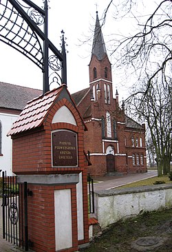
Korsze
Appearance
Korsze | |
|---|---|
 Roman Catholic church | |
| Country | |
| Voivodeship | Warmian-Masurian |
| County | Kętrzyn |
| Gmina | Korsze |
| Area | |
| • Total | 4.03 km2 (1.56 sq mi) |
| Population (2006) | |
| • Total | 4,632 |
| • Density | 1,100/km2 (3,000/sq mi) |
| Postal code | 11-430 |
Korsze [ˈkɔrʂɛ] (German: Korschen, Lithuanian: Kuršiai) is a town in Kętrzyn County, Warmian-Masurian Voivodeship, Poland, with 4,724 inhabitants (2004). It is a railroad junction, located along the major Olsztyn - Ełk - Białystok line, with less important connections to Bartoszyce and Skandawa.
Before 1945 the area was part of Germany (East Prussia). Following World War II the native German populace was expelled and replaced by Poles.
Wikimedia Commons has media related to Korsze.

