Kozet
Appearance
Kozet
Козет | |
|---|---|
Aul | |
| Other transcription(s) | |
| • Adyghe | Козэт |
| Coordinates: 44°59′N 38°59′E / 44.983°N 38.983°E[1] | |
| Country | Russia |
| Federal subject | Adygea |
| Founded | 1789 |
| Elevation | 45 m (148 ft) |
| Time zone | UTC+3 (MSK |
| Postal code(s)[3] | |
| OKTMO ID | 79630417101 |
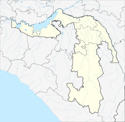
Kozet (Russian: Козет; Adyghe: Козэт) is a rural locality (an aul) and the administrative center of Kozetskoye Rural Settlement of Takhtamukaysky District, the Republic of Adygea, Russia. The population was 2203 as of 2018.[4] There are 82 streets.
Geography
[edit]The aul is located on the left bank of the Kuban River, 10 km north of Takhtamukay (the district's administrative centre) by road. Novy is the nearest rural locality.[5]
Ethnicity
[edit]The aul is inhabited by Adyghes, Russians and Armenians.
References
[edit]- ^ Карта аула Козет в республике Адыгея
- ^ "Об исчислении времени". Официальный интернет-портал правовой информации (in Russian). 3 June 2011. Retrieved 19 January 2019.
- ^ Почта России. Информационно-вычислительный центр ОАСУ РПО. (Russian Post). Поиск объектов почтовой связи (Postal Objects Search) (in Russian)
- ^ "Численность постоянного населения по МО и населенным пунктам Республики Адыгея по состоянию на 1 января 2018 года". Archived from the original on 2018-08-01. Retrieved 2018-09-17.
- ^ Расстояние от Козета до Тахтамукая


