
Kraftisried
Kraftisried | |
|---|---|
 Coat of arms | |
Location of Kraftisried within Ostallgäu district 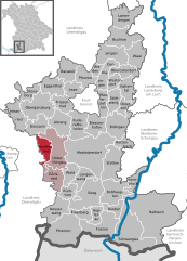 | |
 Kraftisried  Kraftisried | |
| Coordinates: 47°47′N 10°28′E / 47.783°N 10.467°E | |
| Country | Germany |
| State | Bavaria |
| Admin. region | Schwaben |
| District | Ostallgäu |
| Government | |
| • Mayor | Johann Hartmann |
| Area | |
| • Total | 16.22 km2 (6.26 sq mi) |
| Highest elevation | 911 m (2,989 ft) |
| Lowest elevation | 920 m (3,020 ft) |
| Population (2022-12-31)[1] | |
| • Total | 924 |
| • Density | 57/km2 (150/sq mi) |
| Time zone | UTC+01:00 (CET) |
| • Summer (DST) | UTC+02:00 (CEST) |
| Postal codes | 87647 |
| Dialling codes | 08377 |
| Vehicle registration | OAL |
| Website | www.kraftisried.de |
Kraftisried is a municipality in the district of Ostallgäu in Bavaria in Germany.
Towns and municipalities in Ostallgäu | ||
|---|---|---|
|  | |
References
- ^ Genesis Online-Datenbank des Bayerischen Landesamtes für Statistik Tabelle 12411-003r Fortschreibung des Bevölkerungsstandes: Gemeinden, Stichtag (Einwohnerzahlen auf Grundlage des Zensus 2011).
| International | |
|---|---|
| National | |
This Ostallgäu location article is a stub. You can help Wikipedia by expanding it. |