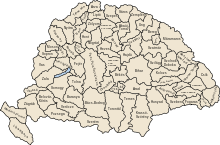
Kraszna County
Appearance
| Kraszna County | |
|---|---|
| County of the Kingdom of Hungary | |
| c. 1100 (first mentioned in 1164)–1876 | |
 | |
| Capital | Krasznavár[1] Valkóvár[1] Szilágysomlyó |
| History | |
• Established | c. 1100 (first mentioned in 1164) |
• Disestablished | 1876 |
| Today part of | Romania |
Kraszna county (Hungarian: Kraszna vármegye) was a historic administrative county (comitatus) of the Kingdom of Hungary along the river Kraszna, its territory is now in north-western Romania.[2] Its capital cities were Krasznavár (today in German: Krassmarkt, Romanian: Crasna), Valkóvár (Romanian: Cetatea Valcău) and Szilágysomlyó (German: Schomlenmarkt, Romanian: Șimleu Silvaniei).
References
- ^ a b Benkő 1994, p. 381.
- ^ Benkő 1994, p. 380.
Sources
- Benkő, Elek (1994). "Kraszna 2.". In Kristó, Gyula; Engel, Pál; Makk, Ferenc (eds.). Korai magyar történeti lexikon (9-14. század) [Encyclopedia of the Early Hungarian History (9th-14th centuries)] (in Hungarian). Akadémiai Kiadó. p. 380-381. ISBN 963-05-6722-9.
{{cite book}}: Invalid|ref=harv(help)
