Kukenán-tepui
| Kukenán Tepui | |
|---|---|
 Kukenan Tepui | |
| Highest point | |
| Elevation | 2,680 m (8,790 ft) |
| Coordinates | 5°12′36.38″N 60°49′52.18″W / 5.2101056°N 60.8311611°W |
| Geography | |
| Location | Venezuela |
| Parent range | Guyana Highlands |
| Geology | |
| Mountain type | Plateau |
| Climbing | |
| Easiest route | Hike |
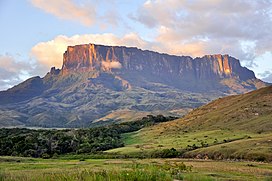
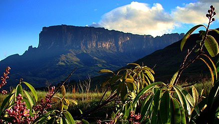
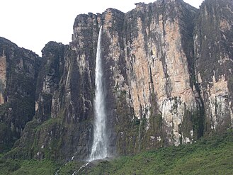
Kukenán, also known as Matawi or Cuquenán, is a tepui in Bolívar State, Guayana Region, Venezuela. It has an estimated surface area of 2185 hectares (equivalent to 21.85 square kilometres). It is 2,680 metres (8,790 ft) high and about 3 km (1.9 mi) long. Kukenan Falls, which is 674 m (2,211 ft) high, is located at the south end of the tepui.[1]
Kukenán is located in Canaima National Park. Next to Kukenán, to the southeast, is Mount Roraima, a better known tepui. Kukenán is more difficult to climb, so it is ascended much less frequently than Mount Roraima.[2]
Canaima National Park is also home to the highest waterfall in the world, which is located in Auyán Tepui.[3]
Scenery on top of Kukenán provided inspiration for the 2009 film Up. [citation needed]
|
See also
[edit]References
[edit]- ^ Kukenaam, Salto Archived 11 June 2011 at the Wayback Machine. World Waterfall Database.
- ^ Kukenan Tepui. SummitPost. 24 July 2007.
- ^ "Kukenan Tepui : Climbing, Hiking & Mountaineering : SummitPost". www.summitpost.org.
Further reading
[edit]- Kok, P.J.R., R.D. MacCulloch, D.B. Means, K. Roelants, I. Van Bocxlaer & F. Bossuyt (7 August 2012). "Low genetic diversity in tepui summit vertebrates" (PDF). Archived from the original (PDF) on 5 June 2013. Current Biology 22(15): R589–R590. doi:10.1016/j.cub.2012.06.034 ["supplementary information" (PDF).[permanent dead link]][permanent dead link]


