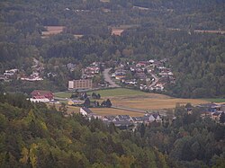
Kvelde
Kvelde | |
|---|---|
village | |
 | |
| Coordinates: 59°11′33″N 9°58′08″E / 59.19250°N 9.96889°E | |
| Country | Norway |
| County | Vestfold |
| Municipality | Larvik |
| Area | |
| • Total | 0.76 km2 (0.29 sq mi) |
| Population (2014) | |
| • Total | 3,000 |
| • Density | 3,900/km2 (10,000/sq mi) |
| Time zone | UTC+1 (CET) |
| • Summer (DST) | UTC+2 (CEST) |
| Postal code | 3282 |
Kvelde is a village in the municipality of Larvik, Norway. Its population is 3000 i 2014 og 885 (2011).[1]
The village is located along the banks of the Numedalslågen. The name stems from a local word meaning "turn of the river". Musekollen is the highest point. The local church dates from 1871.
References
- ^ "Tabell 1 Tettsteder. Folkemengde og areal, etter kommune. 1.januar 2011". Statistics Norway. Archived from the original on June 30, 2012. Retrieved June 30, 2012.
{{cite web}}: Unknown parameter|deadurl=ignored (|url-status=suggested) (help)
