Kwu Tung station
Appearance
| Proposed MTR rapid transit station | ||||||||||||||||
| Chinese name | ||||||||||||||||
| Chinese | 古洞 | |||||||||||||||
| ||||||||||||||||
| General information | ||||||||||||||||
| Location | Kwu Tung North District, Hong Kong | |||||||||||||||
| Coordinates | 22°30′27″N 114°06′00″E / 22.5076°N 114.1001°E | |||||||||||||||
| Owned by | KCR Corporation | |||||||||||||||
| Operated by | MTR Corporation | |||||||||||||||
| Line(s) | ||||||||||||||||
| Platforms | 4 (2 island platforms) | |||||||||||||||
| Tracks | 4 | |||||||||||||||
| Construction | ||||||||||||||||
| Structure type | Underground | |||||||||||||||
| Other information | ||||||||||||||||
| Station code | KTU | |||||||||||||||
| Services | ||||||||||||||||
| ||||||||||||||||
| ||||||||||||||||
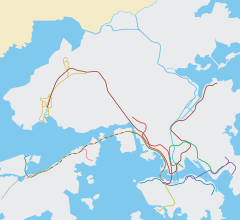
Kwu Tung (Chinese: 古洞站) is a proposed station on the Lok Ma Chau Spur Line (a branch of the East Rail Line) of the MTR rapid transit network in Hong Kong. It is proposed to be situated near Kwu Tung in North District, New Territories.
The station is now still a proposed station; however, there is an area left underground for the future Kwu Tung Station, as the Hong Kong Government's investigation found that 689 hectares of land in the Kwu Tung–Fanling area is suitable for development of a new town. Because of this, the station may well be developed in the future, so there must be an area left for the future station.
Gallery
-
The place reserved for the building of Kwu Tung station in the future
-
Area reserved for platform structure
-
Kwu Tung station under construction (January 2005)
External links


