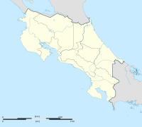
La Cruz, Costa Rica
This article needs additional citations for verification. (January 2017) |
La Cruz | |
|---|---|
District and town | |
| Coordinates: 11°1′24″N 85°38′08″W / 11.02333°N 85.63556°W | |
| Country | Costa Rica |
| Province | Guanacaste |
| Canton | La Cruz |
| Area | |
| • Total | 346.22 km2 (133.68 sq mi) |
| Elevation | 255 m (837 ft) |
| Population (June 2013) | |
| • Total | 11,063 |
| • Density | 32/km2 (83/sq mi) |
| Postal code | 51010 |
La Cruz is a city and the administrative center of the canton of La Cruz canton in the province of Guanacaste in Costa Rica.[1]
La Cruz District had 11,063 inhabitants in 2013.[2] It is located entirely north of the country, near the border with Nicaragua.
Villages
Administrative center of the district is the town of La Cruz.
Other villages in the district are Bellavista, Bello Horizonte, Brisas, Cacao, Carrizal, Carrizales, Colonia Bolaños, Copalchí, Infierno, Jobo, Monte Plata, Montes de Oro, Pampa, Pegón, Peñas Blancas, Piedra Pómez, Puerto Soley, Recreo, San Buenaventura, San Dimas, San Paco, San Roque, Santa Rogelia, Santa Rosa, Soley, Sonzapote, Tempatal and Vueltas.[1]
References
- ^ a b "La Cruz". Retrieved 2015-03-25.
- ^ Estadísticas Vitales 2013 Archived 2015-09-24 at the Wayback Machine - INEC
External links

