Langlade (community), Wisconsin
Appearance
Langlade, Wisconsin | |
|---|---|
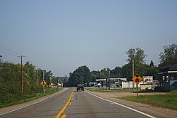
 Looking north at downtown Langlade on WIS 55 | |
 | |
| Country | United States |
| State | Wisconsin |
| County | Langlade |
| Time zone | UTC-6 (Central (CST)) |
| • Summer (DST) | UTC-5 (CDT) |
| Area code(s) | 715 & 534 |
| GNIS feature ID | 1579627[1] |
Langlade is an unincorporated community located in the town of Wolf River in Langlade County, Wisconsin, United States.[2] It is located at the intersection of Wisconsin Highway 55 and Wisconsin Highway 64.[3]
References
- ^ U.S. Geological Survey Geographic Names Information System: Langlade (community), Wisconsin
- ^ Langlade County (PDF) (Map). Wisconsin Department of Transportation. 2011. Retrieved August 23, 2011.
- ^ "Google maps for Langlade, Wisconsin". Google Maps. Retrieved December 20, 2009.
45°11′24″N 88°43′56″W / 45.18997°N 88.73233°W

