
Launac
Launac | |
|---|---|
 | |
Location of Launac  | |
 Launac  Launac | |
| Coordinates: 43°44′38″N 1°10′53″E / 43.7439°N 1.1814°E | |
| Country | France |
| Region | Occitania |
| Department | Haute-Garonne |
| Arrondissement | Toulouse |
| Canton | Léguevin |
| Intercommunality | Save et Garonne |
| Government | |
| • Mayor (2008–2014) | Jean Arrecgros |
| Area 1 | 22.32 km2 (8.62 sq mi) |
| Population (2008) | 1,210 |
| • Density | 54/km2 (140/sq mi) |
| Time zone | UTC+01:00 (CET) |
| • Summer (DST) | UTC+02:00 (CEST) |
| INSEE/Postal code | 31281 /31330 |
| Elevation | 139–253 m (456–830 ft) (avg. 135 m or 443 ft) |
| 1 French Land Register data, which excludes lakes, ponds, glaciers > 1 km2 (0.386 sq mi or 247 acres) and river estuaries. | |
Launac is a commune in the Haute-Garonne department in southwestern France.
Population
| Year | Pop. | ±% |
|---|---|---|
| 1962 | 478 | — |
| 1968 | 516 | +7.9% |
| 1975 | 516 | +0.0% |
| 1982 | 626 | +21.3% |
| 1990 | 740 | +18.2% |
| 1999 | 963 | +30.1% |
| 2008 | 1,210 | +25.6% |
Sights
The Château de Launac is a 15th-century castle with additions and alterations from the 16th and 17th centuries. Privately owned, it is listed as a historic site by the French Ministry of Culture.[1]
Sights
-
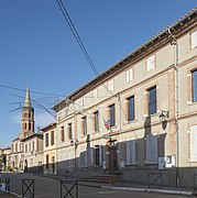 Town hall.
 -
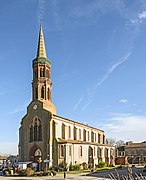 Church
 -
 Covered market
 -
 Castle


See also
References
- ^ www.culture.gouv.fr, accessed 16 March 2008
Wikimedia Commons has media related to Launac.
This Haute-Garonne geographical article is a stub. You can help Wikipedia by expanding it. |