Lee Acres, New Mexico
Appearance
Lee Acres, New Mexico | |
|---|---|
Census-designated place | |
| Coordinates: 36°42′59″N 108°04′03″W / 36.71639°N 108.06750°W | |
| Country | United States |
| State | New Mexico |
| County | San Juan |
| Area | |
• Total | 13.1 sq mi (34 km2) |
| • Land | 12.9 sq mi (33 km2) |
| • Water | 0.2 sq mi (0.5 km2) |
| Elevation | 5,522 ft (1,683 m) |
| Population | |
• Total | 5,858 |
| • Density | 450/sq mi (170/km2) |
| Time zone | UTC-7 (Mountain (MST)) |
| • Summer (DST) | UTC-6 (MDT) |
| GNIS feature ID | 2584139[3] |
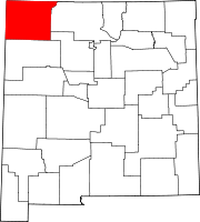
Lee Acres is a census-designated place in San Juan County, New Mexico, United States. Its population was 5,858 as of the 2010 census.[2] It is located on U.S. Route 64 between Farmington and Bloomfield.
References
- ^ "2010 Census Gazetteer Files". United States Census Bureau. Retrieved 2014-12-07.
- ^ a b "American FactFinder". United States Census Bureau. Retrieved 2014-12-07.
- ^ "Lee Acres". Geographic Names Information System. United States Geological Survey, United States Department of the Interior.


