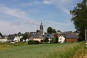
Leupoldsgrün
Appearance
Leupoldsgrün | |
|---|---|
Location of Leupoldsgrün within Hof district  | |
| Coordinates: 50°17′N 11°48′E / 50.283°N 11.800°E | |
| Country | Germany |
| State | Bavaria |
| Admin. region | Oberfranken |
| District | Hof |
| Municipal assoc. | Schauenstein |
| Subdivisions | 6 Ortsteile |
| Government | |
| • Mayor | Annika Popp (CSU) |
| Area | |
| • Total | 10.26 km2 (3.96 sq mi) |
| Highest elevation | 630 m (2,070 ft) |
| Lowest elevation | 590 m (1,940 ft) |
| Population (2023-12-31)[1] | |
| • Total | 1,208 |
| • Density | 120/km2 (300/sq mi) |
| Time zone | UTC+01:00 (CET) |
| • Summer (DST) | UTC+02:00 (CEST) |
| Postal codes | 95191 |
| Dialling codes | 09292 |
| Vehicle registration | HO |
| Website | www.leupoldsgruen.de |
Leupoldsgrün is a municipality in Upper Franconia. It can be found in the district of Hof, which is part of Bavaria, Germany. 2014 the 26 years old Annika Popp (CSU) ran for chief of town.[2]

References
- ^ Genesis Online-Datenbank des Bayerischen Landesamtes für Statistik Tabelle 12411-003r Fortschreibung des Bevölkerungsstandes: Gemeinden, Stichtag (Einwohnerzahlen auf Grundlage des Zensus 2011).
- ^ "Politik macht einfach Spaß" (in German). Nordbayerischer Kurier, 1 April 2014.


