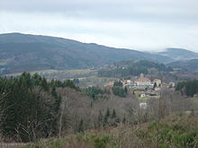
Livradois-Forez Regional Natural Park
Appearance
Template:Geobox Livradois-Forez Regional Natural Park (French: Parc naturel régional Livradois-Forez) is a protected area of woodlands and traditional farmland in the Auvergne and Rhône-Alpes regions of central France. Spanning the departments of Puy-de-Dôme, Haute-Loire, and Loire, the park covers a total area of 297,000 hectares (730,000 acres).[1]
Within its borders, the park contains more than 150 small communes. The park's main information center is located in Saint-Gervais-sous-Meymont.[2] The area was officially designated as a regional natural park in 1986.[1]

See also
References
- ^ a b IUCN Commission on National Parks and Protected Areas (November 1990). 1990 United Nations list of national parks and protected areas. IUCN. p. 89. ISBN 978-2-8317-0032-8. Retrieved 3 September 2011.
- ^ Rosemary Bailey (2007). National Geographic Traveler France. National Geographic Books. p. 227. ISBN 978-1-4262-0027-4. Retrieved 4 September 2011.
External links
Categories:
- Regional natural parks of France
- Geography of Puy-de-Dôme
- Geography of Haute-Loire
- Geography of Loire (department)
- Protected areas established in 1986
- Visitor attractions in Auvergne-Rhône-Alpes by department
- Visitor attractions in Auvergne-Rhône-Alpes
- Visitor attractions in Haute-Loire
- Visitor attractions in Puy-de-Dôme
- Visitor attractions in Loire (department)
- 1986 establishments in France
- European protected area stubs
