Loch Bracadale
Appearance

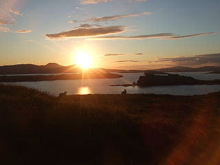
Loch Bracadale (Scottish Gaelic: Loch Bhràcadail) is a sea loch on the west coast of Skye in Scotland.
Loch Bracadale and its associated inner lochs - Harport, Vatten, Caroy, Bharcasaig, na Faolinn and Loch Beag - form one of the largest areas of semi-enclosed inshore waters around the Skye coast.[1] The shallow waters are exploited for fish and mussel farms as well as scallop diving. The loch contains Harlosh Island, Tarner Island, Wiay and the tidal island of Oronsay off Ullinish point.
Just beyond Idrigill Point on the west are sea stacks known as Macleod's Maidens.
See also
References
- ^ "Loch Bracadale Aquaculture Framework Plan" (PDF). Highland Council. October 2002. Archived from the original (PDF) on 2007-10-23. Retrieved 2007-07-18.
{{cite web}}: Unknown parameter|deadurl=ignored (|url-status=suggested) (help)
