Lustleigh Cleave
| Lustleigh Cleave | |
|---|---|
 View onto Lustleigh Cleave | |
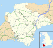
Location in Devon | |
| Length | 2 miles (3.2 km) North West-South East |
| Geography | |
| Coordinates | 50°37′16″N 3°44′49″W / 50.621°N 3.747°W |
| River | River Bovey |
The Lustleigh Cleave is a steep sided valley above the River Bovey[1] in the parish of Lustleigh on Dartmoor. The cleave has been noted for its beauty since the 1800s,[2][3] and features extensively in guidebooks.[4][5]
Description
[edit]The Lustleigh Cleave is a steep-sided valley, approximately 2 miles (3.2 km) in length, with the River Bovey flowing at the bottom approximately South-Easterly.[6]
Nothing can spoil the Cleave, where the granite, piled up like giants' castles, crowns the gorge, and is spread all the way to the stream below.
— Cresswell, 1920[7]
The valley is scattered with granite clitter (rocks strewn across the landscape), including rocking logan stones.[8]
Notable features
[edit]The cleave contains Hunter's Tor, a granite tor, typical of Dartmoor, and location of an Iron Age settlement, and later Domesday book settlement of Sutreworde.[9][10]
There is regeneration of temperate rainforest on the Lustleigh Cleave, following a reduction in grazing and swaling.[11][12][13][14]
References
[edit]- ^ Crossing, William (1914). Guide to Dartmoor; a topographical description of the forest and the commons. Plymouth Western Morning News Co. p. 72.
- ^ Rowe, Samuel (1898). A perambulation of the antient and royal forest of Dartmoor and the Venville precincts, or a topographical survey of their antiquities and scenery. JG Commin. p. 136.
- ^ Nicholls Worth, Richard (1880). Tourist's guide to South Devon. London: Edward Stanford. pp. 76–77.
- ^ A handbook for travellers in Devonshire (9th Revised ed.). London: John Murray. 1879. pp. 143–149.
- ^ Baddeley, MJB; Ward, CS (1884). South Devon and South Cornwall. London: Dulau and Co. pp. 96–98.
- ^ Crossing, William. Gems in a granite setting; beauties of the lone land of Dartmoor. pp. 75–79.
- ^ Cresswell, Beatric F (1920). Dartmoor with its surroundings; a handbook for visitors. London Homeland Association. p. 34.
- ^ Rowe, Samuel; Rowe, Joshua Brooking (1896). A perambulation of the antient and royal forest of Dartmoor and the Venville precincts, or a topographical survey of their antiquities and scenery. Exeter: JG Commin. pp. 136–137.
- ^ "Hunter's Tor (Lustleigh)". Tors of Dartmoor.
- ^ Mortimer, Ian (December 2021). "The Location and Extent of King Alfred's Suðewyrðe". Reports and Transactions of the Devonshire Association for the Advancement of Science. 153: 227–254.
- ^ Shrubsole, Guy (29 April 2021). "Life finds a way: in search of England's lost, forgotten rainforests". The Guardian.
- ^ Parker, George (16 December 2022). "In search of Britain's lost rainforests". Financial Times.
- ^ Jones, Lucy (17 February 2023). "The plan to restore Britain's lost rainforests". Positive News.
- ^ Shrubsole, Guy (2022). The Lost Rainforests of Britain. HarperCollins. ISBN 978-0-00-852795-2.

