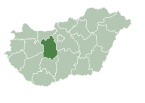
Mány
Appearance
Mány | |
|---|---|
| Country | |
| County | Fejér |
| Area | |
• Total | 44.72 km2 (17.27 sq mi) |
| Population (2004) | |
• Total | 2,374 |
| • Density | 53.08/km2 (137.5/sq mi) |
| Time zone | UTC+1 (CET) |
| • Summer (DST) | UTC+2 (CEST) |
| Postal code | 2065 |
| Area code | 22 |
| Website | www |
Location
Mány is located in the northeast side of Fejér county, in the Zsámbéki-basin.
History
In the middle ages Mány was in Esztergom county. Mány and Örs were fully destroyed in the first decades of the Turkish occupation. From 1611 there was a Batthyány estate, but in 1680 Batthyány family pledged their estates in Mány and Bicske. In 1703 Mány was moved to Fejér county. At the World War I 630 young man joined the army, and 115 them never returned home. For them, Mány set a monument in 1927. In 1944 World War II reached Mány. The Soviet ring surrounding Budapest was located in the border of Mány.
Relations
Mány's German sister city is Leimen[disambiguation needed], and the Szekely sister village is Mezőbánd in Mures county.
External links


