Madan Saddle
Appearance


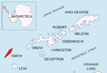
Madan Saddle (Template:Lang-bg, ‘Madanska Sedlovina’ \ma-'dan-ska se-dlo-vi-'na\) is a saddle of elevation 1110 m in Imeon Range on Smith Island, South Shetland Islands bounded by Neofit Peak to the northeast and Riggs Peak to the south-southwest. Overlooking Gramada Glacier to the southeast. Bulgarian early mapping in 2009. Named after the town of Madan in the Rhodope Mountains, southern Bulgaria.
63°01′37″S 62°36′05″W / 63.02694°S 62.60139°W
Map
- L.L. Ivanov. Antarctica: Livingston Island and Greenwich, Robert, Snow and Smith Islands. Scale 1:120000 topographic map. Troyan: Manfred Wörner Foundation, 2009. ISBN 978-954-92032-6-4
References
This article includes information from the Antarctic Place-names Commission of Bulgaria which is used with permission.
