Marokopa River
Appearance
| Marokopa River | |
|---|---|
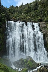
 Marokopa River at Marokopa Falls | |
| Location | |
| Country | New Zealand |
| Region | Waikato Region |
| Physical characteristics | |
| Source | |
| • location | Waitomo District |
| Mouth | |
• location | Tasman Sea |
• elevation | 0 m (0 ft) |
| Length | 26 km (16 mi) |
The Marokopa River is a river of the Waikato Region of New Zealand.[1] It flows west for approximately 26 kilometres (16 mi) to join the Tasman Sea at Marokopa. Near Te Anga, the river flows over the picturesque[2] Marokopa Falls.
See also
References
- ^ "Place name detail: Marokopa River". New Zealand Gazetteer. New Zealand Geographic Board. Retrieved 2010-04-23.
- ^ Marokopa Falls walk ("often described as the most beautiful in the country", from the New Zealand Department of Conservation website. Accessed 2013-07-20.)
38°18′26″S 174°42′56″E / 38.307235°S 174.715666°E
