Massif des Brasses
Appearance
| Massif des Brasses | |
|---|---|
 | |
 A view of Les Brasses | |
| Location | Saint-Jeoire |
| Nearest major city | Cluses |
| Coordinates | 46°10′05″N 6°26′56″E / 46.1680°N 6.4490°E |
| Vertical | 623 m (2,044 ft) |
| Top elevation | 1,503 m (4,931 ft) |
| Base elevation | 880 m (2,890 ft) |
| Trails |
|
| Lift system |
|
| Terrain parks | 0 |
| Snowmaking | 73 snow cannons[2] |
| Night skiing | No |
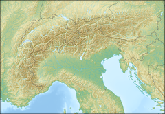
Massif des Brasses is a mid-sized ski area in the Haute-Savoie region of France. The ski area is located in the commune of Saint-Jeoire, at the head of the Giffre valley. It is marketed as a close ski destination to Geneva, with a claimed transfer time of 20 minutes from the Genevan basin.[1]
References
External links

