Mazama Glacier (Mount Adams)
| Mazama Glacier | |
|---|---|
 Mazama Glacier at lower center of image | |
| Type | Mountain glacier |
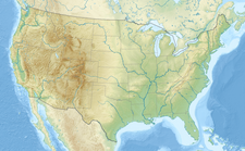
| Location | Mount Adams, Yakima County, Washington, USA |
| Coordinates | 46°10′49″N 121°28′12″W / 46.18028°N 121.47000°W[1] |
| Area | 1.40 km2 (0.54 sq mi) in 2006[2] |
| Length | 1.10 mi (1.77 km) |
| Terminus | Talus |
| Status | Retreating |
Mazama Glacier is located on the southeast slopes of Mount Adams, a stratovolcano in the U.S. state of Washington. Mazama Glacier is in the Yakama Indian Reservation.[3] The glacier descends from approximately 10,800 ft (3,300 m) to a terminus near 7,600 ft (2,300 m).[3] Mazama Glacier has been in a general state of retreat for over 100 years and lost 46 percent of its surface area between 1904 and 2006.[2]
Originally known as Hell-roaring Glacier, the name was changed in 1895 by a group from the Mazamas club while they were on their second annual outing.[4]
Climate
[edit]Lunch Counter camp lies along the eastern edge of Mazama Glacier, upon Suksdorf Ridge at an elevation of 9,350 ft (2,850 m).[5] There is no weather station, but this climate table contains interpolated data.
| Climate data for Lunch Counter 46.1784 N, 121.4797 W, Elevation: 9,341 ft (2,847 m) (1991–2020 normals) | |||||||||||||
|---|---|---|---|---|---|---|---|---|---|---|---|---|---|
| Month | Jan | Feb | Mar | Apr | May | Jun | Jul | Aug | Sep | Oct | Nov | Dec | Year |
| Mean daily maximum °F (°C) | 25.1 (−3.8) |
24.6 (−4.1) |
25.9 (−3.4) |
29.9 (−1.2) |
38.7 (3.7) |
45.7 (7.6) |
56.7 (13.7) |
57.1 (13.9) |
51.5 (10.8) |
40.6 (4.8) |
28.5 (−1.9) |
23.8 (−4.6) |
37.3 (3.0) |
| Daily mean °F (°C) | 19.6 (−6.9) |
17.7 (−7.9) |
17.9 (−7.8) |
20.8 (−6.2) |
28.6 (−1.9) |
34.9 (1.6) |
44.3 (6.8) |
44.6 (7.0) |
39.7 (4.3) |
31.0 (−0.6) |
22.5 (−5.3) |
18.5 (−7.5) |
28.3 (−2.0) |
| Mean daily minimum °F (°C) | 14.0 (−10.0) |
10.8 (−11.8) |
10.0 (−12.2) |
11.7 (−11.3) |
18.5 (−7.5) |
24.0 (−4.4) |
32.0 (0.0) |
32.2 (0.1) |
27.9 (−2.3) |
21.4 (−5.9) |
16.5 (−8.6) |
13.1 (−10.5) |
19.3 (−7.0) |
| Average precipitation inches (mm) | 14.05 (357) |
10.88 (276) |
11.12 (282) |
7.50 (191) |
5.05 (128) |
3.45 (88) |
0.97 (25) |
1.37 (35) |
3.29 (84) |
8.02 (204) |
13.81 (351) |
15.38 (391) |
94.89 (2,412) |
| Source: PRISM Climate Group[6] | |||||||||||||
See also
[edit]References
[edit]- ^ "Mazama Glacier". Geographic Names Information System. United States Geological Survey, United States Department of the Interior. Retrieved November 11, 2012.
- ^ a b Sitts, Danielle; Andrew G. Fountain; Matthew J. Hoffman (2010). "Twentieth Century Glacier Change on Mount Adams, Washington, USA" (pdf). Northwest Science. 84 (4). Northwest Scientific Association: 378–385. doi:10.3955/046.084.0407. Retrieved November 11, 2012.
- ^ a b Mount Adams East, WA (Map). TopoQwest (United States Geological Survey Maps). Retrieved November 11, 2012.
- ^ Rusk, Claude Ewing (1978) [1924]. Tales of a Western Mountaineer (1st ed.). Seattle, Washington: The Mountaineers. ISBN 0-916890-62-7. LCCN 78054427. OCLC 4667368. OL 11004497M. Retrieved March 29, 2016.
- ^ Lunch Counter (Map). OregonHikers.org. Retrieved October 6, 2023.
- ^ "PRISM Climate Group, Oregon State University". PRISM Climate Group, Oregon State University. Retrieved October 5, 2023.
To find the table data on the PRISM website, start by clicking Coordinates (under Location); copy Latitude and Longitude figures from top of table; click Zoom to location; click Precipitation, Minimum temp, Mean temp, Maximum temp; click 30-year normals, 1991-2020; click 800m; click Interpolate grid cell values; click Retrieve Time Series button.


