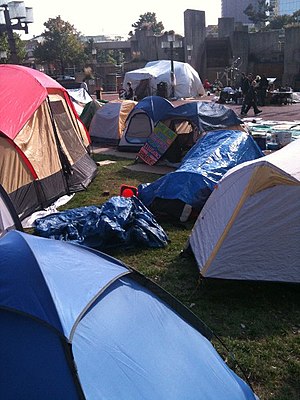
McKeldin Square

McKeldin Square is an area of Downtown Baltimore, located near the Inner Harbor at the corners of Pratt and Light Streets.
The central area is a polygon of brick. On the Pratt St. side there is a strip of grass; behind the brick there is a pool at the base of a multi-leveled concrete structure with walkways and fountains.[1][2]
The location of the square puts it right in the middle of Baltimore's 1861 riots, during which locals turned on a Union regiment that was passing through the city.
McKeldin Square has been designated as Baltimore's zone for protests, where it is legal to exercise one's First Amendment rights and pass out pamphlets.[3] Permits are required for groups with groups of 25 or more requiring a permit. On October 4, 2011, it became the location of the Occupy Baltimore protests until their December 13 eviction.
References
- ^ Wylson, Anthony (1986). Aquatecture: architecture and water. Architectural Press. p. 63.
{{cite book}}: Cite has empty unknown parameter:|coauthors=(help) - ^ Snedcof, Harold R. (1985). Cultural facilities in mixed-use development. Urban Land Institute. p. 236.
{{cite book}}: Cite has empty unknown parameter:|coauthors=(help) - ^ Walker, Andrea K. (September 18, 2011). "Spray-paint artist arrested at Inner Harbor". The Baltimore Sun. Retrieved 17 November 2011.
