Jump to content

Mill Run, Tucker County, West Virginia

Coordinates: 39°00′53″N 79°32′48″W / 39.01472°N 79.54667°W / 39.01472; -79.54667
From Wikipedia, the free encyclopedia

This is an old revision of this page, as edited by Illegitimate Barrister (talk | contribs) at 02:34, 15 January 2018 (→‎top: clean up, replaced: Political divisions of the United States|State → U.S. state|State, List of countries| → List of sovereign states|, United States → United States (2) using AWB). The present address (URL) is a permanent link to this revision, which may differ significantly from the current revision.

Mill Run, West Virginia
Mill Run, West Virginia is located in West Virginia
Mill Run, West Virginia
Coordinates: 39°00′53″N 79°32′48″W / 39.01472°N 79.54667°W / 39.01472; -79.54667
CountryUnited States
StateWest Virginia
CountyTucker
Elevation
1,906 ft (581 m)
GNIS feature ID1689383[1]

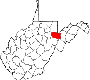
Mill Run is a ghost town in Tucker County, West Virginia, United States. Mill Run was located on the Dry Fork 3 miles (4.8 km) northwest of Red Creek. Mill Run appeared on Soil Conservation Service maps as late as 1921.

References