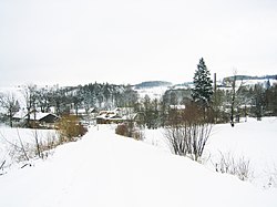
Miłoszów
Miłoszów | |
|---|---|
Village | |
 Miłoszów in winter | |
| Coordinates: 51°00′16″N 15°15′00″E / 51.00444°N 15.25000°E | |
| Country | |
| Voivodeship | Lower Silesian |
| County | Lubań |
| Gmina | Leśna |
| Highest elevation | 325 m (1,066 ft) |
| Lowest elevation | 190 m (620 ft) |
| Population | 780 |
| Time zone | UTC+1 (CET) |
| • Summer (DST) | UTC+2 (CEST) |
| Website | http://miloszow.pl |
Miłoszów [miˈwɔʂuf] is a village in the administrative district of Gmina Leśna, within Lubań County, Lower Silesian Voivodeship, in south-western Poland, on the border with the Czech Republic.[1]
It lies approximately 3 kilometres (2 mi) south-west of Leśna, 13 kilometres (8 mi) south of Lubań, and 126 kilometres (78 mi) west of the regional capital Wrocław.
During World War II the Germans established and operated a subcamp of the Gross-Rosen concentration camp in the village, with around 600 prisoners, mostly Poles.[2] In February 1945, the Germans ordered the evacuation of the camp, during which at least 100 exhausted prisoners were murdered.[2] A group of ill prisoners was left in the camp and later transported to Gross-Rosen on 19 March 1945.[2]
References
[edit]- ^ "Central Statistical Office (GUS) – TERYT (National Register of Territorial Land Apportionment Journal)" (in Polish). 2008-06-01.
- ^ a b c "Subcamps of KL Gross- Rosen". Gross-Rosen Museum in Rogoźnica. Retrieved 18 April 2020.


