
Montongo, Arkansas
Montongo, Arkansas | |
|---|---|
 Montongo  Montongo | |
| Coordinates: 33°44′35″N 91°49′20″W / 33.74306°N 91.82222°W | |
| Country | United States |
| State | Arkansas |
| County | Drew |
| Elevation | 384 ft (117 m) |
| Time zone | UTC-6 (Central (CST)) |
| • Summer (DST) | UTC-5 (CDT) |
| Area code | 870 |
| GNIS feature ID | 79042[1] |
Montongo is an unincorporated community in Drew County, Arkansas, United States. Montongo is located on U.S. Route 425, 8.1 miles (13.0 km) north-northwest of Monticello.[2]
References
- ^ "Montongo". Geographic Names Information System. United States Geological Survey, United States Department of the Interior.
- ^ Drew County, Arkansas General Highway Map (PDF) (Map). Arkansas State Highway and Transportation Department. 2009. Retrieved February 16, 2013.
Municipalities and communities of Drew County, Arkansas, United States | ||
|---|---|---|
| Cities | 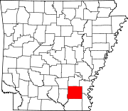 | |
| Towns | ||
| CDPs | ||
| Other unincorporated communities | ||
| Footnotes | ‡This populated place also has portions in an adjacent county or counties | |
This Arkansas state location article is a stub. You can help Wikipedia by expanding it. |