
Murphreesboro, Mississippi
Murphreesboro, Mississippi | |
|---|---|
 Murphreesboro, Mississippi Location within the state of Mississippi | |
| Coordinates: 33°53′58″N 89°58′27″W / 33.89944°N 89.97417°W | |
| Country | United States |
| State | Mississippi |
| County | Tallahatchie |
| Elevation | 253 ft (77 m) |
| Time zone | UTC-6 (Central (CST)) |
| • Summer (DST) | UTC-5 (CDT) |
| GNIS feature ID | 708148[1] |
Murphreesboro (also New Hope) is a ghost town in Tallahatchie County, Mississippi, United States.
Murphreesboro was located approximately 10 mi (16 km) southeast of Charleston. Ascalmore Creek flowed through the settlement.
Murphreesboro had a post office and a school. In 1900, the population was 56.[2][3][4]
Blues guitarist Hayes McMullen was born in Murphreesboro in 1902.[5]
References
- ^ U.S. Geological Survey Geographic Names Information System: Murphreesboro (historical)
- ^ Rowland, Dunbar (1907). Mississippi: Comprising Sketches of Counties, Towns, Events, Institutions, and Persons, Arranged in Cyclopedic Form. Vol. 2. Southern Historical Publishing Association. p. 286.
- ^ U.S. Geological Survey Geographic Names Information System: Murphreesboro Post Office (historical)
- ^ U.S. Geological Survey Geographic Names Information System: Murphreesboro School
- ^ Eagle, Bob L.; LeBlanc, Eric S. (2013). Blues: A Regional Experience. ABC-CLIO. p. 217.
Municipalities and communities of Tallahatchie County, Mississippi, United States | ||
|---|---|---|
| City | 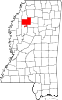 | |
| Towns | ||
| Village | ||
| Unincorporated communities | ||
| Ghost towns | ||
| Footnotes | ‡This populated place also has portions in an adjacent county or counties | |
This United States ghost town-related article is a stub. You can help Wikipedia by expanding it. |