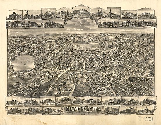
Newton Centre, Massachusetts
Appearance
Newton Centre, Massachusetts | |
|---|---|
Village | |
 Union Street | |
| Coordinates: 42°19′50″N 71°11′40″W / 42.33056°N 71.19444°W | |
| Country | |
| State | Massachusetts |
| County | Middlesex |
| City | Newton |
| Elevation | 90 m (300 ft) |
| Time zone | UTC-5 (Eastern (EST)) |
| • Summer (DST) | UTC-4 (EDT) |
| ZIP Code | 02459 |
| Area code | 617 |
Newton Centre is a village of Newton, Massachusetts. The main commercial center of Newton Centre is a triangular area surrounding the intersections of Beacon Street, Centre Street, and Langley Road. It is the largest downtown area among all the villages of Newton, and serves as a large upscale shopping destination for the western suburbs of Boston. The Newton City Hall and War Memorial is located at 1000 Commonwealth Avenue in Newton Centre. [1]
Education
K-12 Education
- The Newton Montessori School is a private school located at 80 crescent street in Newton Centre
- Mason-Rice Elementary School is a public elementary school operated by Newton Public Schools located at 149 Pleasant Street
Colleges and universities
- The Boston College Law School campus, which also includes undergraduate housing, is located on Centre Street at the Newton Centre-Newton Corner line.
- Andover Newton Theological School is located on Herrick Road in Newton Centre.
- Hebrew College is also located on Herrick Road in Newton Centre.
- Mount Ida College is located on Dedham Street, which is approximately five miles from Newton Centre. Mount Ida also includes undergraduate housing and is widely known for is Veterinary Technologist Program.
Historic pictorial map

See also
References
- ^ "Newton City Hall 1000 Commonwealth Ave Newton, MA City Government-Executive Offices - MapQuest". www.mapquest.com. Retrieved 2017-03-29.
External links
Wikimedia Commons has media related to Newton Centre, Massachusetts.

