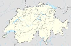
Niederrickenbach Station railway station
Niederrickenbach Station | |||||
|---|---|---|---|---|---|
| General information | |||||
| Location | Kantonstrasse Wolfenschiessen, Nidwalden Switzerland | ||||
| Coordinates | 46°55′40″N 8°23′47″E / 46.927671°N 8.396451°E | ||||
| Elevation | 488 m (1,601 ft) | ||||
| Operated by | Zentralbahn | ||||
| Line(s) | Luzern–Stans–Engelberg line (Zentralbahn) | ||||
| |||||
Niederrickenbach Station is a Swiss railway station in the municipality of Wolfenschiessen in the canton of Nidwalden. It is on the Luzern–Stans–Engelberg line, owned by the Zentralbahn railway company. The station is adjacent to the lower station of the cable car, to the hamlet of Niederrickenbach and the convent of Maria-Rickenbach, from which it takes its name.[1][2]
Niederrickenbach station is 2.3 km (1.4 mi) horizontally and 650 m (2,130 ft) vertically from Niederrickenbach hamlet. Unusually, and perhaps for this reason, the German language railway timetable includes the word Station as part of the name of this railway station. Because of the distance the station was made a request stop.[1][3]
The station is served by the following passenger trains:[3]
| Operator | Train Type | Route | Typical Frequency | Notes |
|---|---|---|---|---|
| Zentralbahn | InterRegio | Lucerne - Hergiswil - Stans - Dallenwil - Niederrickenbach Station - Wolfenschiessen - Dörfli - Grafenort - Engelberg | 1 per hour |
The station is also served by the cable car to the hamlet of Niederrickenbach and the convent of Maria-Rickenbach, which operates every half-hour.[4]
References
- ^ a b map.geo.admin.ch (Map). Swiss Confederation. Retrieved 2013-01-08.
- ^ Eisenbahnatlas Schweiz. Verlag Schweers + Wall GmbH. 2012. p. 22. ISBN 978-3-89494-130-7.
- ^ a b "Luzern–Stans–Engelberg" (PDF). Bundesamt für Verkehr. Retrieved 2013-01-14.
- ^ "Dallenwil–Niederrickenbach" (PDF). Bundesamt für Verkehr. Retrieved 2013-01-14.

