Nong Kop
Appearance
Nong Kop
หนองกบ | |
|---|---|
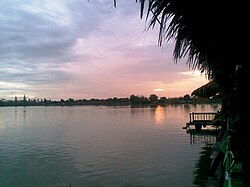
 Lakeside at sunset. Bueng, Nong Kop. | |
| Coordinates: 13°49′N 99°56′E / 13.817°N 99.933°E[1] | |
| Country | Thailand |
| Province | Ratchaburi |
| Amphoe | Ban Pong |
| Elevation | 300 m (1,000 ft) |
| Time zone | UTC+7 (ICT) |
Nong Kop (Thai: หนองกบ) is a sub-district (tambon) in Ban Pong district, Ratchaburi Province, Thailand.
Overview
Nong Kop Sub-district is flat. Its name, meaning "frog pond", derives from the many ponds and marshes in the area where frogs thrive. There is much gravel and sand extraction in the sub-district, an activity which has left the landscape dotted with small lakes.[3] The sub-district has many Lao Wiang communities.[4] The specialty of the sub-district is grilled chicken from Bang Tan village.[5]
See also
References

