Nordenskiöld Bay
| Nordenskiöld Bay | |
|---|---|
| Nordenskiöldbukta Error {{native name checker}}: parameter value is malformed (help) | |
| Location | Nordaustlandet, Svalbard |
| Coordinates | 80°23′04″N 21°35′09″E / 80.38444°N 21.58583°E |
| Ocean/sea sources | Arctic Ocean |
| Basin countries | Norway |
| Max. width | 46.3 km (28.8 mi) |
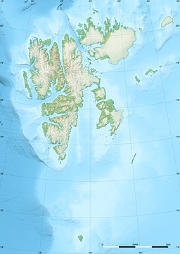
Nordenskiöld Bay (Norwegian: Nordenskiöldbukta) is a bay on the northern coast of Nordaustlandet, Svalbard.
The bay is named after Arctic explorer Adolf Erik Nordenskiöld.
Geography
Located between Laponiahalvøya and Prins Oscars Land, the bay is facing north and has a width of about 25 nautical miles. It contains several fjords and smaller bays, including Ekstremfjorden, Sabinebukta, Carolusbukta and Rijpfjorden.[1][2]
References
- ^ "Nordenskiöldbukta (Svalbard)". Norwegian Polar Institute. Retrieved 29 June 2013.
- ^ Arctic Pilot: Sailing directions Svalbard–Jan Mayen. Vol. 7. Stavanger: The Norwegian Hydrographic Service and The Norwegian Polar Institute. 1988. pp. 307, 323. ISBN 82-90653-06-9.

