
Nuland
Nuland | |
|---|---|
 Coat of arms | |
 The former town hall of Nuland | |
| Coordinates: 51°43′37″N 5°26′2″E / 51.72694°N 5.43389°E | |
| Country | Netherlands |
| Province | North Brabant |
| Municipality | 's-Hertogenbosch |
| Population (2004) | 4,380 |
Nuland is a village in the Dutch province of North Brabant. It is located about 8 km (5 mi) east of 's-Hertogenbosch.
Nuland was a separate municipality until 1993, when merged with Geffen and Vinkel to create the new municipality of Maasdonk.[1] This lasted until 2015, when Maasdonk was dissolved and Nuland became part of 's-Hertogenbosch.
-
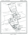 Map of Nuland in 1867

References
- ^ Ad van der Meer and Onno Boonstra, Repertorium van Nederlandse gemeenten, KNAW, 2011.
External links
- Template:Kuyper Map of the former municipality, around 1868.
This North Brabant location article is a stub. You can help Wikipedia by expanding it. |