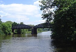
Nuneham Viaduct
Appearance
Nuneham Railway Bridge | |
|---|---|
 Nuneham Railway Bridge from downstream | |
| Coordinates | 51°40′10″N 1°14′27″W / 51.669456°N 1.240878°W |
| Carries | Cherwell Valley Line |
| Crosses | River Thames |
| Locale | Abingdon, Oxfordshire |
| Maintained by | Network Rail |
| Characteristics | |
| Height | 15 feet 9 inches (4.80 m)[1] |
| History | |
| Opened | 1929 |
| Location | |
 | |
Nuneham Railway Bridge is a railway bridge in England near the town of Abingdon, Oxfordshire. It carries the Cherwell Valley Line between Didcot and Oxford across the River Thames between Abingdon Lock and Sandford Lock. The current bridge was built in 1929 and has also been called the Black Bridge. It replaced an earlier wooden bridge built in 1844.
See also
References
- ^ River Thames Alliance. Bridge heights on the River Thames.
