Nyttingnes
You can help expand this article with text translated from the corresponding article in Norwegian. (November 2013) Click [show] for important translation instructions.
|
Nyttingnes | |
|---|---|
Village | |
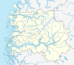
Location in Sogn og Fjordane county | |
| Coordinates: 61°35′42″N 05°13′00″E / 61.59500°N 5.21667°E | |
| Country | Norway |
| Region | Western Norway |
| County | Sogn og Fjordane |
| District | Sunnfjord |
| Municipality | Flora |
| Elevation | 35 m (115 ft) |
| Population (2001)[2] | |
| • Total | 28 |
| Time zone | UTC+01:00 (CET) |
| • Summer (DST) | UTC+02:00 (CEST) |
| Post Code | 6940 Eikefjord |
Nyttingnes is a hamlet with 28 inhabitants and 9 houses in the municipality of Flora in Sogn og Fjordane county, Norway.[2] Nyttingnes is located 6 kilometres (3.7 mi) northwest of the village of Steinhovden and about 3 kilometres (1.9 mi) across the fjord from the village of Brandsøy. The town of Florø lies about 8 kilometres (5.0 mi) to the west, although the road from Nyttingnes to Florø goes around the fjord via the village of Eikefjord (a 40-kilometre long drive). In recent history, there has been a negative demographic trend in this village. Nyttingnes is made up of the farms: Tunet, Bakken, Pergarden, Ludviggarden, Kvia, Opptun and Rabbane. Historically, the inhabitants were farmers and fishermen. The nearby Skårafjæra beach area is popular for many tourists.
References
- ^ "Nyttingnes" (in Norwegian). yr.no. Retrieved 2010-08-08.
- ^ a b Statistisk sentralbyrå (2001). "Folke- og boligtellingen 2001, kommune- og bydelshefter 1401 Flora" (PDF) (in Norwegian).
{{cite journal}}: Cite journal requires|journal=(help)


