
Oak, Nebraska
Oak, Nebraska | |
|---|---|
 Downtown Oak: north side of Maple Street | |
 Location of Oak, Nebraska | |
| Country | United States |
| State | Nebraska |
| County | Nuckolls |
| Area | |
| • Total | 0.15 sq mi (0.39 km2) |
| • Land | 0.15 sq mi (0.39 km2) |
| • Water | 0 sq mi (0 km2) |
| Elevation | 1,588 ft (484 m) |
| Population | |
| • Total | 66 |
| • Estimate (2012[3]) | 65 |
| • Density | 440.0/sq mi (169.9/km2) |
| Time zone | UTC-6 (Central (CST)) |
| • Summer (DST) | UTC-5 (CDT) |
| ZIP code | 68964 |
| Area code | 402 |
| FIPS code | 31-35245 |
| GNIS feature ID | 0831792[4] |
Oak is a village in Nuckolls County, Nebraska, United States. The population was 66 at the 2010 census.
History
The first settlement was made in the Oak area in the 1860s. Oak was platted on its current site in 1888 when the Fremont, Elkhorn & Missouri Valley Railroad was extended to that point.[5] It was named from nearby Oak Creek.[6]
Geography
Oak is located at 40°14′14″N 97°54′11″W / 40.23722°N 97.90306°W (40.237287, -97.902920).[7]
According to the United States Census Bureau, the village has a total area of 0.15 square miles (0.39 km2), all of it land.[1]
Demographics
| Census | Pop. | Note | %± |
|---|---|---|---|
| 1910 | 237 | — | |
| 1920 | 201 | −15.2% | |
| 1930 | 218 | 8.5% | |
| 1940 | 177 | −18.8% | |
| 1950 | 131 | −26.0% | |
| 1960 | 125 | −4.6% | |
| 1970 | 100 | −20.0% | |
| 1980 | 79 | −21.0% | |
| 1990 | 68 | −13.9% | |
| 2000 | 60 | −11.8% | |
| 2010 | 66 | 10.0% | |
| 2015 (est.) | 64 | [8] | −3.0% |
| U.S. Decennial Census[9] 2012 Estimate[10] | |||
2010 census
As of the census[2] of 2010, there were 66 people, 30 households, and 15 families residing in the village. The population density was 440.0 inhabitants per square mile (169.9/km2). There were 38 housing units at an average density of 253.3 per square mile (97.8/km2). The racial makeup of the village was 98.5% White and 1.5% from two or more races. Hispanic or Latino of any race were 1.5% of the population.
There were 30 households of which 33.3% had children under the age of 18 living with them, 46.7% were married couples living together, 3.3% had a female householder with no husband present, and 50.0% were non-families. 40.0% of all households were made up of individuals and 3.3% had someone living alone who was 65 years of age or older. The average household size was 2.20 and the average family size was 3.07.
The median age in the village was 33.5 years. 25.8% of residents were under the age of 18; 7.6% were between the ages of 18 and 24; 33.4% were from 25 to 44; 25.8% were from 45 to 64; and 7.6% were 65 years of age or older. The gender makeup of the village was 54.5% male and 45.5% female.
2000 census
As of the census of 2000, there were 60 people, 31 households, and 15 families residing in the village. The population density was 405.1 people per square mile (154.4/km²). There were 36 housing units at an average density of 243.1 per square mile (92.7/km²). The racial makeup of the village was 100.00% White.
There were 31 households out of which 25.8% had children under the age of 18 living with them, 38.7% were married couples living together, and 48.4% were non-families. 41.9% of all households were made up of individuals and 25.8% had someone living alone who was 65 years of age or older. The average household size was 1.94 and the average family size was 2.63.
In the village the population was spread out with 20.0% under the age of 18, 13.3% from 18 to 24, 16.7% from 25 to 44, 18.3% from 45 to 64, and 31.7% who were 65 years of age or older. The median age was 46 years. For every 100 females there were 114.3 males. For every 100 females age 18 and over, there were 118.2 males.
As of 2000 the median income for a household in the village was $21,875, and the median income for a family was $27,500. Males had a median income of $19,688 versus $12,500 for females. The per capita income for the village was $11,460. There were 5.0% of families and 17.5% of the population living below the poverty line, including 46.2% of under eighteens and 19.0% of those over 64.
Notable people
- Russ Snyder, baseball player
References
- ^ a b "US Gazetteer files 2010". United States Census Bureau. Archived from the original on July 14, 2012. Retrieved 2012-06-24.
{{cite web}}: Unknown parameter|deadurl=ignored (|url-status=suggested) (help) - ^ a b "American FactFinder". United States Census Bureau. Retrieved 2012-06-24.
- ^ "Population Estimates". United States Census Bureau. Archived from the original on June 17, 2013. Retrieved 2013-05-29.
{{cite web}}: Unknown parameter|deadurl=ignored (|url-status=suggested) (help) - ^ "US Board on Geographic Names". United States Geological Survey. 2007-10-25. Retrieved 2008-01-31.
- ^ "Oak, Nuckolls County". Center for Advanced Land Management Information Technologies. University of Nebraska. Retrieved 20 August 2014.
- ^ Chicago and North Western Railway Company (1908). A History of the Origin of the Place Names Connected with the Chicago & North Western and Chicago, St. Paul, Minneapolis & Omaha Railways. p. 109.
- ^ "US Gazetteer files: 2010, 2000, and 1990". United States Census Bureau. 2011-02-12. Retrieved 2011-04-23.
- ^ "Annual Estimates of the Resident Population for Incorporated Places: April 1, 2010 to July 1, 2015". Retrieved July 2, 2016.
- ^ United States Census Bureau. "Census of Population and Housing". Archived from the original on May 11, 2015. Retrieved October 16, 2013.
{{cite web}}: Unknown parameter|deadurl=ignored (|url-status=suggested) (help) - ^ "Annual Estimates of the Resident Population: April 1, 2010 to July 1, 2012". Retrieved October 16, 2013.
Municipalities and communities of Nuckolls County, Nebraska, United States | ||
|---|---|---|
| Cities | 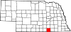 | |
| Villages | ||
| Unincorporated communities | ||
| Ghost town | ||