
Oberaurach
Oberaurach | |
|---|---|
 Tretzendorf Castle, today the town hall of Oberaurach | |
 Coat of arms | |
Location of Oberaurach within Haßberge district 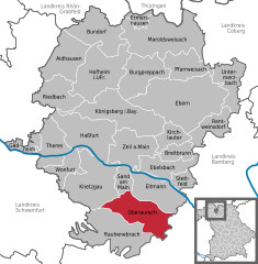 | |
 Oberaurach  Oberaurach | |
| Coordinates: 49°55′N 10°37′E / 49.917°N 10.617°E | |
| Country | Germany |
| State | Bavaria |
| Admin. region | Unterfranken |
| District | Haßberge |
| Subdivisions | 8 Ortsteile |
| Government | |
| • Mayor | Thomas Sechser (CSU) |
| Area | |
| • Total | 36.76 km2 (14.19 sq mi) |
| Elevation | 350 m (1,150 ft) |
| Population (2022-12-31)[1] | |
| • Total | 4,008 |
| • Density | 110/km2 (280/sq mi) |
| Time zone | UTC+01:00 (CET) |
| • Summer (DST) | UTC+02:00 (CEST) |
| Postal codes | 97514 |
| Dialling codes | 09529 |
| Vehicle registration | HAS |
| Website | www.oberaurach.de |
Oberaurach is a municipality in the district of Haßberge in Bavaria in Germany.
There are 8 quarters belonging to Oberaurach:
- Dankenfeld and Seesbühl
- Fatschenbrunn
- Kirchaich and Nützelsbach
- Neuschleichach
- Oberschleichach
- Tretzendorf
- Trossenfurt and Hummelmarter
- Unterschleichach
References
- ^ Genesis Online-Datenbank des Bayerischen Landesamtes für Statistik Tabelle 12411-003r Fortschreibung des Bevölkerungsstandes: Gemeinden, Stichtag (Einwohnerzahlen auf Grundlage des Zensus 2011) (Hilfe dazu).
Towns and municipalities in Haßberge (district) | ||
|---|---|---|
 | ||
| International | |
|---|---|
| National | |
This Haßberge location article is a stub. You can help Wikipedia by expanding it. |