Odoorn
Odoorn | |
|---|---|
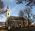
 The library in 2007 | |
Location in the province of Drenthe in the Netherlands | |
| Coordinates: 52°51′N 6°51′E / 52.850°N 6.850°E | |
| Country | Netherlands |
| Province | Drenthe |
| Municipality | Borger-Odoorn |
| Area | |
| • Total | 13.81 km2 (5.33 sq mi) |
| Elevation | 24 m (79 ft) |
| Population (2021)[1] | |
| • Total | 1,890 |
| • Density | 140/km2 (350/sq mi) |
| Time zone | UTC+1 (CET) |
| • Summer (DST) | UTC+2 (CEST) |
| Postal code | 7873[1] |
| Dialing code | 0591 |
Odoorn (Dutch pronunciation: [ˈoːdoːr(ə)n]) is a village in the Dutch province of Drenthe. It is a part of the municipality of Borger-Odoorn, and lies about nine km north of Emmen.
History
[edit]The village was first mentioned in 1327 as "Remboldus in Oderen". It is assumed it means "settlement of the people of Odheri (person)", because older forms often used the suffix -ing.[3]
Odoorn is an esdorp which developed in the Early Middle Ages on the Hondsrug along the road from Groningen to Coevorden. In the 13th century, a daughter church of Anloo was established in the village, and it developed into the central settlement for the satellites Valthe and Exloo.[4]
The Dutch Reformed church was built around 1200 and is built using many large stones. Some of the stones have probably been taken from nearby hunebedden (dolmen). The church suffered a collapse in 1634. It was extensively modified between 1856 and 1857. In 1897, it was restored after a fire.[4][5]
The hunebed (dolmen) D32 is located near Odoorn. It is still half buried in the ground. It used to have five capstones, however one has gone missing.[6]
Odoorn was home to 348 people in 1840.[5] On 22 July 1945, three children were playing with left-over German ammunition, and they were killed when the ammunition exploded. In 1997, a memorial was placed at the site.[7] Odoorn was a separate municipality until 1998, when it merged with Borger.[8]
Festivals
[edit]Odoorn hosts the multi-culture festival SIVO International Folkloristic Dans festival.[5]
Gallery
[edit]-
Street view
-
Village pub
-
Hunebed (dolmen) D32
-
Dutch Reformed church
References
[edit]- ^ a b c "Kerncijfers wijken en buurten 2021". Central Bureau of Statistics. Retrieved 11 April 2022.
- ^ "Postcodetool for 7873AA". Actueel Hoogtebestand Nederland (in Dutch). Het Waterschapshuis. Retrieved 11 April 2022.
- ^ "Odoorn - (geografische naam)". Etymologiebank (in Dutch). Retrieved 11 April 2022.
- ^ a b Ronald Stenvert (2001). Odoorn (in Dutch). Zwolle: Waanders. p. 61. ISBN 90 400 9454 3. Retrieved 11 April 2022.
- ^ a b c "Odoorn". Plaatsengids (in Dutch). Retrieved 11 April 2022.
- ^ "D32 - Odoorn". Hunebedden (in Dutch). Retrieved 11 April 2022.
- ^ "Odoorn, monument in de boswachterij Odoorn". 4 en 5 mei (in Dutch). Retrieved 11 April 2022.
- ^ Ad van der Meer and Onno Boonstra, Repertorium van Nederlandse gemeenten, KNAW, 2011.
External links
[edit] Media related to Odoorn at Wikimedia Commons


