
Ogallala, Nebraska
Ogallala, Nebraska | |
|---|---|
 Location of Ogallala, Nebraska | |
| Country | United States |
| State | Nebraska |
| County | Keith |
| Area | |
| • Total | 3.4 sq mi (8.8 km2) |
| • Land | 3.3 sq mi (8.7 km2) |
| • Water | 0.1 sq mi (0.2 km2) |
| Elevation | 3,222 ft (982 m) |
| Population (2000) | |
| • Total | 4,930 |
| • Density | 1,472.4/sq mi (568.5/km2) |
| Time zone | UTC-7 (Mountain (MST)) |
| • Summer (DST) | UTC-6 (MDT) |
| ZIP code | 69153 |
| Area code | 308 |
| FIPS code | 31-35980Template:GR |
| GNIS feature ID | 0831832Template:GR |
Ogallala is a city in Keith County, Nebraska, United States. The population was 4,930 at the 2000 census. It is the county seat of Keith CountyTemplate:GR. In the days of the Nebraska Territory, the city was a stop on the Pony Express and later along the transcontinental railroad. The Ogallala Aquifer was named after the city.
History
Ogallala first gained fame as a terminus for cattle drives that traveled from Texas to the Union Pacific railhead located there. These trails are known as the Western or Great Western trails. [1] [2] The Union Pacific Railroad reached Ogallala on May 24, 1867. [3]
Geography
Ogallala is located at 41°7′44″N 101°43′10″W / 41.12889°N 101.71944°WInvalid arguments have been passed to the {{#coordinates:}} function (41.128806, -101.719460)Template:GR.
According to the United States Census Bureau, the city has a total area of 3.4 square miles (8.8 km²), of which, 3.3 square miles (8.7 km²) of it is land and 0.1 square miles (0.2 km²) of it (1.76%) is water.
Ogallala is in the US Mountain Time Zone (UTC-7/-6).
Ogallala is close to Lake McConaughy, a large man-made lake and a state recreation area with sandy beaches, boating, and swimming.
Demographics
As of the censusTemplate:GR of 2000, there were 4,930 people, 2,052 households, and 1,339 families residing in the city. The population density was 1,472.4 people per square mile (568.2/km²). There were 2,314 housing units at an average density of 691.1/sq mi (266.7/km²). The racial makeup of the city was 96.45% White, 0.02% African American, 0.87% Native American, 0.22% Asian, 1.68% from other races, and 0.75% from two or more races. Hispanic or Latino of any race were 4.79% of the population.
There were 2,052 households out of which 31.5% had children under the age of 18 living with them, 53.0% were married couples living together, 9.5% had a female householder with no husband present, and 34.7% were non-families. 30.7% of all households were made up of individuals and 14.7% had someone living alone who was 65 years of age or older. The average household size was 2.35 and the average family size was 2.94.
In the city the population was spread out with 26.5% under the age of 18, 6.7% from 18 to 24, 26.5% from 25 to 44, 21.9% from 45 to 64, and 18.4% who were 65 years of age or older. The median age was 39 years. For every 100 females there were 89.0 males. For every 100 females age 18 and over, there were 85.0 males.
The median income for a household in the city was $32,141, and the median income for a family was $39,688. Males had a median income of $27,436 versus $18,292 for females. The per capita income for the city was $17,674. About 5.0% of families and 7.8% of the population were below the poverty line, including 9.3% of those under age 18 and 9.1% of those age 65 or over.
References
External links


Municipalities and communities of Keith County, Nebraska, United States | ||
|---|---|---|
| City | 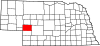 | |
| Villages | ||
| CDPs | ||
| Unincorporated communities | ||