Ohre
Appearance
| Ohre | |
|---|---|
 | |
 | |
| Physical characteristics | |
| Mouth | Elbe 52°18′40″N 11°45′55″E / 52.31111°N 11.76528°E |
| Length | 103 km (64 mi) |
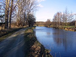
The Ohre is a river in northern Germany, left tributary to the Elbe. Its total length is 103 kilometres (64 mi). Its source is north of Wolfsburg, in Lower Saxony. It flows generally south-east, at first following the border of Lower Saxony and Saxony-Anhalt. After Buchhorst it flows completely through Saxony-Anhalt, along the Mittellandkanal. It flows into the Elbe in Rogätz, north of Magdeburg. The towns Brome, Calvörde, Haldensleben and Wolmirstedt lie along the river. The upper course of the Ohre is in the Drömling nature reserve.
