
Opawa, Lower Silesian Voivodeship
Opawa | |
|---|---|
Village | |
 | |
| Country | |
| Voivodeship | Lower Silesian |
| County | Kamienna Góra |
| Gmina | Lubawka |
Opawa [ɔˈpava] (German: Oppau) is a village in the administrative district of Gmina Lubawka, within Kamienna Góra County, Lower Silesian Voivodeship, in south-western Poland. Prior to 1945 it was in Germany. After World War II the region was placed under Polish administration and ethnically cleansed according to the post-war Potsdam Agreement. The native German populace was expelled and replaced with Poles.
-
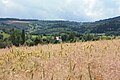 Opawa latem
 -
 Church in Opawa


External links
| Town and seat |  | |
|---|---|---|
| Villages | ||
50°42′02″N 15°53′38″E / 50.7006°N 15.8939°E
This Kamienna Góra County location article is a stub. You can help Wikipedia by expanding it. |