Otterburne
Appearance
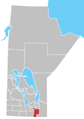
Otterburne is a small settlement located about 50 kilometers south of Winnipeg. It is named after Otterburn in England, and is perhaps best known as the location of Providence University College and Theological Seminary. It is located in the Rural Municipality of De Salaberry. On July 30, 2005, a wind storm reaching speeds of over 150 km/h ripped through the Otterburne area, destroying trees, damaging buildings, and picking up irrigation wheels which weighed over 15 tonnes.[1] Eyewitnesses reported that they had seen a tornado.
References
External links
49°29′50″N 97°03′06″W / 49.49722°N 97.05167°W

