
Pansy, West Virginia
Pansy, West Virginia | |
|---|---|
 Pansy  Pansy | |
| Coordinates: 38°53′48″N 79°11′52″W / 38.89667°N 79.19778°W | |
| Country | United States |
| State | West Virginia |
| County | Grant |
| Elevation | 1,093 ft (333 m) |
| Time zone | UTC-5 (Eastern (EST)) |
| • Summer (DST) | UTC-4 (EDT) |
| Area code(s) | 304 & 681 |
| GNIS feature ID | 1554906[1] |
Pansy is an unincorporated community in Grant County, West Virginia, USA. Located on U.S. Route 220 6.45 miles (10.38 km) south-southwest of Petersburg,[2] the community most likely was named after the garden pansy.[3]
References
- ^ "Pansy". Geographic Names Information System. United States Geological Survey, United States Department of the Interior.
- ^ Grant County, West Virginia, General Highway Map (PDF) (Map). West Virginia Department of Transportation. 2011. p. 2. Retrieved March 22, 2012.[permanent dead link]
- ^ Kenny, Hamill (1945). West Virginia Place Names: Their Origin and Meaning, Including the Nomenclature of the Streams and Mountains. Piedmont, WV: The Place Name Press. p. 471.
Municipalities and communities of Grant County, West Virginia, United States | ||
|---|---|---|
| City | 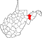 | |
| Town | ||
| Unincorporated communities | ||
| Footnotes | ‡This populated place also has portions in an adjacent county or counties | |
This article about a location in Grant County, West Virginia is a stub. You can help Wikipedia by expanding it. |