Pasque Island
Appearance
| The Elizabeth Islands |
|---|
 |
| Major islands |
| Minor islands |
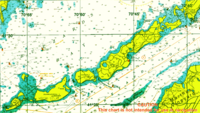
Pasque Island is one of the Elizabeth Islands of Dukes County, Massachusetts, USA. It lies between Nashawena Island to the west and Naushon Island to the east. The island has a land area of 3.45 km² (1.333 sq mi or 853 acres) and had a population of 2 persons as of the 2000 census. [1] The island is part of the town of Gosnold, Massachusetts. 41°27′0.02″N 70°49′34.38″W / 41.4500056°N 70.8262167°W
