Penafiel
Appearance
Penafiel | |
|---|---|
Settlement | |
 Igreja da Misericórdia de Penafiel | |
 | |
| Country | |
| Region | Norte |
| Intermunic. comm. | Tâmega e Sousa |
| District | Porto |
| Area | |
• Total | 212.24 km2 (81.95 sq mi) |
| Population (2011) | |
• Total | 72,265 |
| • Density | 340/km2 (880/sq mi) |
| Time zone | UTC+00:00 (WET) |
| • Summer (DST) | UTC+01:00 (WEST) |
| Website | http://www.cm-penafiel.pt/ |
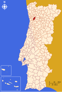
Penafiel (Portuguese pronunciation: [pɨnɐfiˈɛɫ] or [ˌpenɐfiˈɛɫ]) is a municipality in Porto District in the North of Portugal. The population in 2011 was 72,265,[1] in an area of 212.24 km².[2] The municipality of Penafiel is located east of Porto in Tâmega subregion, of which is one of the main cities.
Demographics
| Population of Penafiel Municipality (1801–2008) | ||||||||
|---|---|---|---|---|---|---|---|---|
| 1801 | 1849 | 1900 | 1930 | 1960 | 1981 | 1991 | 2001 | 2011 |
| 18 576 | 26 944 | 31 799 | 37 496 | 49 924 | 64 267 | 68 444 | 71 800 | 72 265 |
Parishes
Administratively, the municipality is divided into 28 civil parishes (freguesias):[3]
- Abragão
- Boelhe
- Bustelo
- Cabeça Santa
- Canelas
- Capela
- Castelões
- Croca
- Duas Igrejas
- Eja
- Fonte Arcada
- Galegos
- Guilhufe e Urrô
- Irivo
- Lagares e Figueira
- Luzim e Vila Cova
- Oldrões
- Paço de Sousa
- Penafiel
- Perozelo
- Rans
- Rio de Moinhos
- Rio Mau
- São Mamede de Recezinhos
- São Martinho de Recezinhos
- Sebolido
- Termas de São Vicente
- Valpedre
References
- ^ Instituto Nacional de Estatística
- ^ Direção-Geral do Território
- ^ Diário da República. "Law nr. 11-A/2013, pages 552 90-91" (pdf) (in Portuguese). Retrieved 29 July 2014.
External links
Wikimedia Commons has media related to Penafiel.


