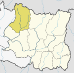
Pheriche

Pheriche फेरिचे is a village in the Khumbu region of eastern Nepal. Situated at an altitude of about 4,371 m (14,340 ft),[1] above the Tsola River,[2] Pheriche is a popular stop for trekkers and climbers. There is a rudimentary hospital in Pheriche that is operated under the auspices of the Himalayan Rescue Association (HRA) which is headquartered in Kathmandu. The Pheriche hospital is open only during the two trekking/climbing seasons (March-May and November-December). Although the hospital was built with Japanese support in 1975, [3] it is staffed by Nepalis and volunteer physicians who are mostly from the USA, Europe, Canada and Australia. Pheriche was primarily a farming village raising potatoes and buckwheat, and keeping yaks. However, now in the summer many of its men are employed by trekkers as guides and bearers. There are also many lodges where trekkers and climbers on their way to the Mt. Everest Base Camp can stay. It is an important acclimatization stopover.
It was heavily damaged in the devastating April 2015 Nepal earthquake, but amazingly, only one local dweller was wounded thus far, at least partly due to what people were doing there at the time and where they were during the day. The area is a relief and treatment center and an evacuation point.[4]
Picture

Notes
- ^ "The Trail to Mount Everest: Practicing Medicine at the World’s Highest Hospital" Himalayan Rescue Association
- ^ The Tsola River flows into the Imja just below Pheriche, and the Imja River flows into the Dudh River below Pangboche.
- ^ "Pheriche Hospital" International Society for Mountain Medicine
- ^ http://news.harvard.edu/gazette/story/2015/04/i-felt-as-if-i-was-on-a-boat-at-sea/

